Michael Shensky joined the Libraries last year as the GIS and Geospatial Data Coordinator to enhance the resources available from the Research Data Services unit with added expertise in Geographic Information Systems, which are increasingly becoming central to our online lives. Shensky took some time to talk about the importance of GIS and where he sees it in the future.
Michael Shensky: Whenever I’m asked what GIS is, and I often am when I tell people what I do for a living, I always start with a very simple definition and expand from there. I typically tell people that GIS is an acronym that stands for geographic information systems and that it is the technology that is used to manage the data behind many of the maps they encounter online and in mobile apps. I also find it helpful to explain that the “geographic information” part of GIS refers to geospatial data (data that features both coordinate information identifying a place on Earth and attribute information that describes something located at that place) while “system” refers to the software and hardware components that are used together to manage this unique type of data effectively.
GIS is incredibly important in our daily lives because it is used to guide and facilitate much of the work that local governments, state and federal government agencies, utility companies, non-profit organizations, and academic researchers carry out. If all GIS software were to suddenly stop working tomorrow, it would be very difficult for those who rely on geospatial data to effectively manage their operations and this would have a dramatic impact on the lives of everyone, not just GIS users. For instance, cities might have difficulty assigning work crews to conduct road repair work if they cannot access their database of pothole locations, fire departments might struggle to respond to the locations of emergencies if they can’t quickly look up the location of an address, and technology companies would see apps that include mapping functionality suddenly break as the data fails to load properly.
While most people do not realize the significant role that GIS software plays behind the scenes in the operations of many organizations, if they look closely enough they can find traces of its impact in their daily lives. If they come across a map when browsing the web, there is a very good chance that GIS software was used to design its layout and manage the data behind the features depicted in it. If a new store or restaurant opens in their neighborhood, it is likely that GIS software was used to analyze demographic and consumer spending data for their local area to determine that this would likely be the most profitable location. If they use the routing functionality built into their car dashboard, the street data used to route them was likely created or edited with GIS software. If they visit the website of their local city or county, it is quite likely they will find a web page designed specifically for sharing geospatial data that has been developed with their taxpayer money and which has been made publically available for anyone to download and use in GIS software.
Given the organic nature of its development, how can standards be developed to manage the proliferation of GIS data?
 MS: In the GIS world, there are open standards developed by non-profit organizations like the Open Geospatial Consortium (OGC) and there are often competing proprietary standards developed by for-profit companies like Esri, whose software products dominate the GIS industry in the United States and many other countries. While we are very fortunate that these standards exist so that there is agreement on how data should be structured and how it should be read by GIS software, there are downsides to having multiple standards to choose from. Having multiple standards to choose from puts GIS professionals in a tough position when we want to share data with others, since we often need to ensure that data is available in multiple standard formats to make it easy for other GIS users to work with the data regardless of whether they are using open source software or Esri’s ArcGIS software. This situation is further complicated by the fact that the popularity of specific standards can fluctuate over time and occasionally completely new standards are developed while older standards may fall into disuse and become functionally obsolete.
For the geospatial data in the UT Libraries’ collections that we are currently in the process of trying to make more easily accessible, we are aiming to share the data in every common standard format that we can. Our goal is to facilitate access to our data for all GIS users, regardless of which software they use or standards they prefer. This approach of making shared datasets available in multiple formats has become quite common on data portals operated by other universities as well as those developed by cities, counties, and federal government agencies. As any good organization would, we plan to stay on top of the latest geospatial data standards and ensure that we are making datasets available in the formats that GIS users expect to find and like to work with.
How did you become a specialist in GIS?
MS: That’s actually a really interesting question, because I sometimes look back on the last decade and wonder that myself. The career path I envisioned for myself shifted quite a bit during my college years and a few chance decisions that didn’t seem particularly significant at the time ended up playing a very substantial role in leading me to the position I’m in today.
As a junior, I was contemplating my changing my major to anthropology or geography since I had really enjoyed taking classes in both disciplines, and I ended up selecting geography partly because I knew that GIS was a required class in that program and that this class would provide me with a technical skill upon graduation. At the time, I had never used or even seen GIS software but I knew it was used to make maps and that sounded really interesting to me. I didn’t actually end up taking that required GIS class until my last semester as an undergraduate and I did I was a surprised to find it a little less exciting and more challenging than I had originally expected. Right after graduation I started applying for a variety of jobs that I thought I might qualify for and the first one I was offered was a paid GIS internship. I didn’t find the job all that interesting at first and during my first few months there did not see myself making a career out of GIS.
This initial lack of fulfillment actually even ended up being a contributing factor in my decision to enroll in a Geography graduate program – I wanted to develop new skills that would open up different job opportunities. While in grad school I continued to work at this same GIS job part time and found that I started to become more interested in the work I was doing as I was assigned more advanced and challenging projects. Because of the GIS skills I gained in this role, I was offered a GIS research assistant position during my last two years of graduate school and then ended developing my master’s thesis project from the work that I did in this role. By the time I completed the work for my master’s degree, my perspective on GIS had changed dramatically, and when I was offered a full time job teaching GIS classes and managing the GIS computers labs for the Geography department at California State University, Long Beach, I was thrilled to have the opportunity to advance my career in GIS. I ended up spending several years in this position which allowed me to further develop my technical skills, gain teaching experience, and develop an even greater respect for the value of GIS software in academic research – all of which prepared me for well for my current role here at the UT Libraries.
What sort of projects have you been working on at UT?
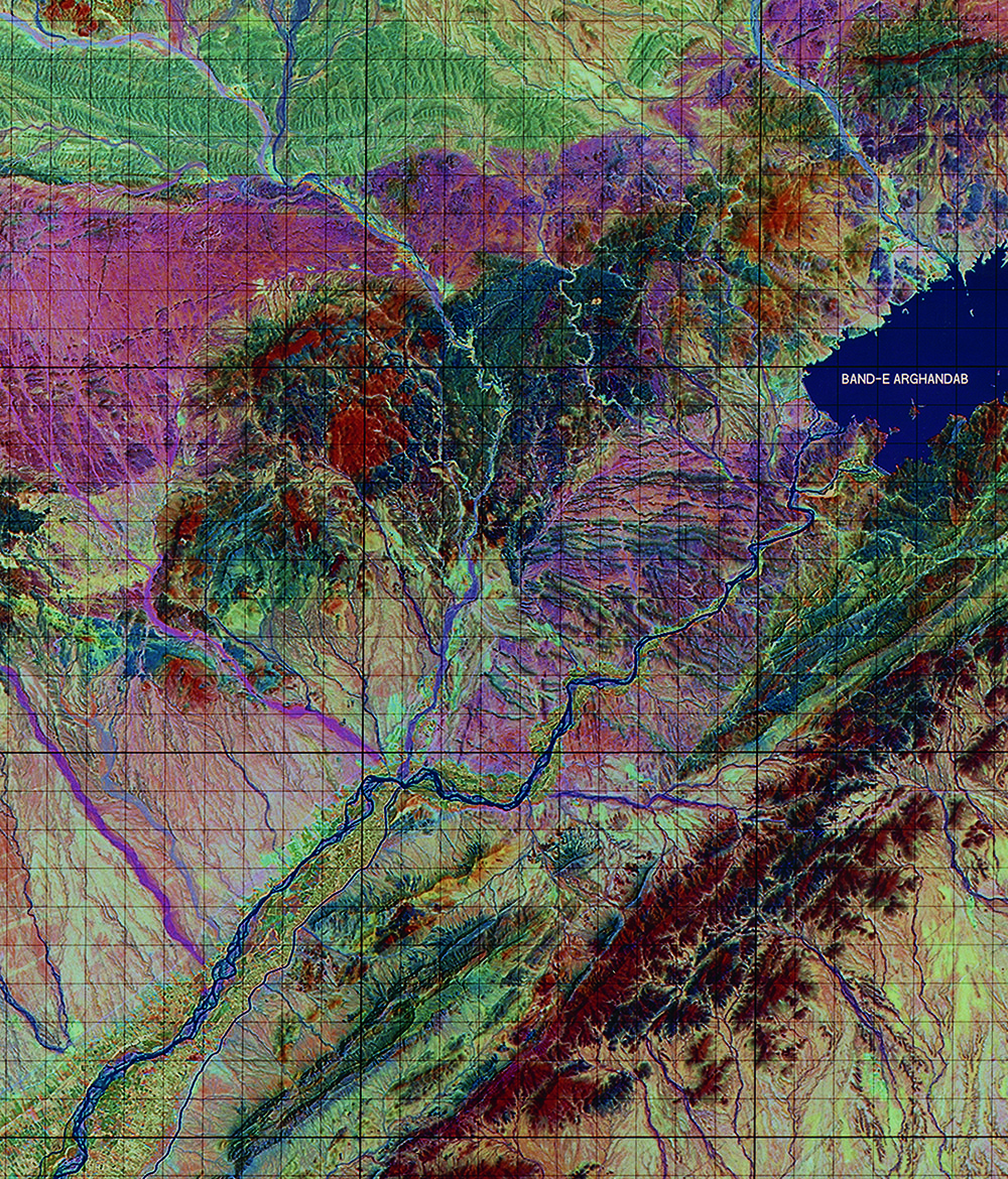
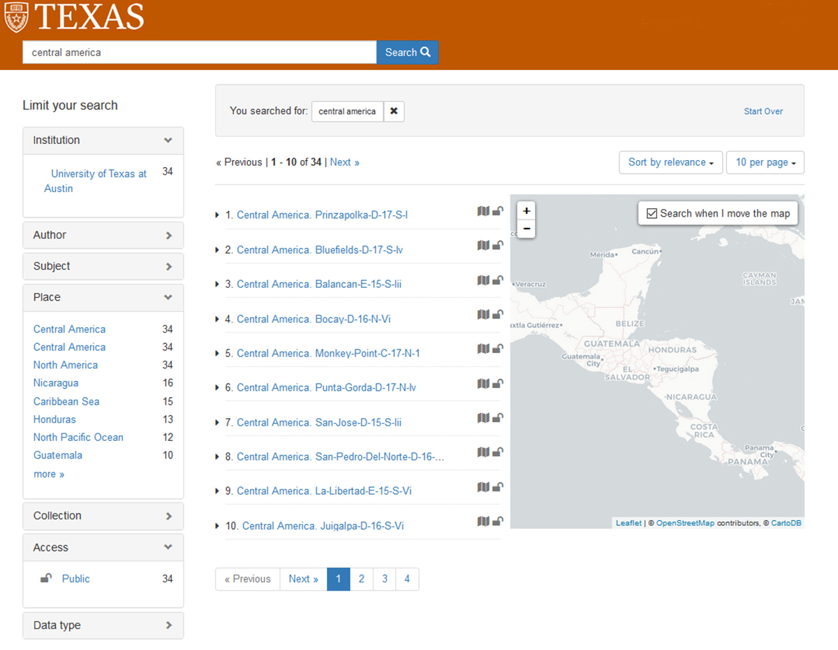
MS: I’ve been working on a few different projects since I started here at UT, the biggest of which is focused on developing a new geospatial data portal that will be part of the UT Libraries website. This portal will allow users to search for geospatial data in our Libraries’ collections that can be used with GIS software. We have been referring to this project internally as the “GeoBlacklight” project because it uses open source software of that name to provide a web interface and data search capabilities. We are optimistic that this project will be completed in the first half of 2019 and that it will be available to the campus community before the start of the fall semester. Once it is rolled out, visitors to the website will be able to search through a variety of geospatial datasets including georeferenced scanned map images from our PCL Map Collection and vector datasets developed from items in other collections like the Benson Latin American Collection and Alexander Architectural Archives. I’m really excited to be a part of this project because I know this portal has the potential to benefit everyone in the campus community regardless of their role and area of specialization. Once the portal is finished and made available, it should be easy for faculty to find data that they can use to develop instructional materials, for students to find data they can use in research projects, for Libraries staff to find data they can use to highlight notable collections, and for everyone in general to browse through when curious about the interesting maps and datasets we have available here at the UT Libraries.

addition to the GeoBlacklight project I have also been working on a program of coordinated outreach and education about GIS both internally within the libraries and externally with departments across campus. As part of this effort I have helped organize events like our recent Local Perspectives on the State of Open Data discussion panel which brought GIS experts from the City of Austin, Travis County, Texas General Land Office, and Texas Natural Resources Information System here to campus to share their thoughts on GIS and open data. I’ve also taught several GIS focused workshops that provided an opportunity for all members of the campus community to learn about GIS and further develop their geospatial research skills. In order to introduce library personnel to some of the capabilities of GIS I’ve also spoken at and helped organize a series of linked data information learning group meetings. I’ve been glad to see that this multifaceted approach has been successful in helping get the word out about GIS on campus and I’ve noticed that I am starting to hear from more and more people each week who are looking to learn more about how they might be able to use GIS in their work.
What are some of the interesting ways GIS will be used in the future?
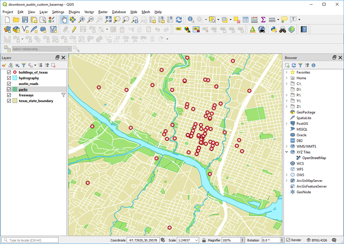
MS: While it’s impossible to know exactly how the way in which we use GIS might change in the future, I think there are a few developments that are all but certain. One of the major developments I foresee is growing awareness of GIS and rapid improvement in the capabilities of open source GIS software like QGIS leading to greater adoption of GIS software in a variety of disciplines and industries. If this prediction proves accurate, the lowering of financial and technical barriers that currently hold people back from using GIS software would greatly benefit small businesses, startups, non-profits, municipalities with limited resources, and more. It should also have a profound impact in the academic world as it will make it easier for researchers to incorporate GIS into their work. I think we will see GIS software being used much more widely in fields like history, journalism, linguistics, ethnic studies, and in the humanities more generally. If this does in fact happen, it will not only open up new avenues for research in these fields but will also make it easier for those working in these different disciplines to work together with each other across departments because they are using a shared technology. Even in disciplines where GIS is already widely used, like geology, biology, geography, and anthropology, I think there will be increased rates of adoption, especially among researchers in developing countries who can start using open source GIS software without having to worry about expensive software licensing or significant software limitations. From my experience in a previous GIS position at another university, I saw firsthand how difficult it could be for researchers in my department to work with colleagues from universities in other countries whose institutions could not afford access to the same proprietary software resources until they all started using open source software to facilitate collaboration.
In addition to the many benefits I think we will see from growing awareness of GIS software and open source GIS software in particular, I think GIS technology will become more useful and powerful as technology continues to improve. Perhaps the biggest impact on GIS will come from new and emerging categories of mobile devices that will make it possible to view and interact with geospatial data in ways that are quite different from the manner in which we engage with geospatial data now on the flat screens of our computer monitors and cell phones. In the 9 years that I have been in this field, there have been several completely new categories of devices that have been released (smart watches, augmented reality glasses, and virtual reality headsets being the most notable) all of which can be used to display new types of maps and I think we will see these technologies mature in a way that will affect how maps are made.
Virtual reality is the currently the most significant of these technologies for working with geospatial data due to the availability of relatively affordable consumer grade headsets and their ability to give users a three dimensional immersive map experience. While I think virtual reality maps will become increasingly common and useful, I think augmented reality devices ultimately hold the most promise of any emerging technology. Right now augmented reality glasses are held back by their high price points, large size, and limited field of view but companies like Microsoft, Google, and Apple have all indicated that they are working on addressing these challenges. If any of these companies (or newer companies like Magic Leap who are also focusing on augmented reality technology) can create a wearable device similar in size to a pair of regular sunglasses, sell it for close to the price of a high end cell phone, and have it effectively overlay 3D objects on top of a user’s normal field of view, I think this would revolutionize how GIS professionals manage data and produce maps. It would also of course open up enormous opportunities for researchers who are looking for new ways to explore geospatial data and visualize their research findings. While a breakthrough like this may not happen this year or next, I think it is just a matter of time before our technology reaches this point and GIS software will have to adapt to facilitate the production of geospatial content for these new types of devices.