Founded in 1867 by D. A. Sanborn, the Sanborn Map Company was the primary American publisher of fire insurance maps for nearly 100 years. A 2007 partnership with the Briscoe Center for American History resulted in a multiyear scanning project that made the Sanborn Fire Insurance Maps for the state of Texas and Mexico (1877-1922) available online through the PCL Map Collection.
Over 10,000 maps were scanned primarily from the Briscoe’s collection, with additional items ingested from the most comprehensive collection of the maps at the Library of Congress, Geography and Map Division, in Washington, D.C.
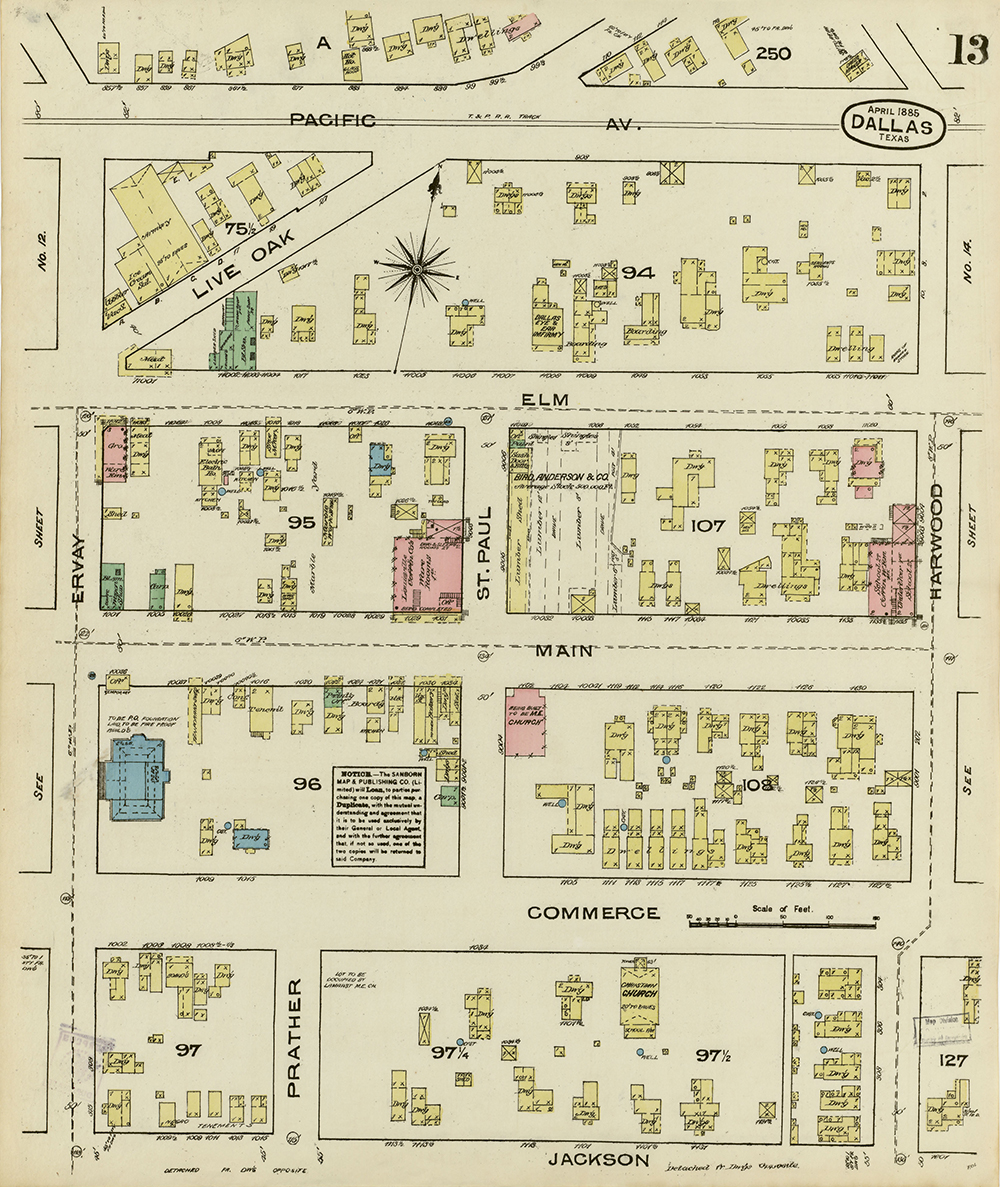
The information on the maps — which were published to determine fire insurance risks of particular buildings — has a multitude of uses for historians, urban planners, architects, social scientists, geographers, genealogists, environmentalists and anyone interested in the history and growth of cities.
Maps include details regarding the shape and size of residential and commercial buildings, street addresses, block numbers and property boundaries, as well as type of construction, type of roof, building height, location of windows and doors, proximity to fire hydrants and alarm boxes. For many of the maps, multiple editions exist that allow for the study of change over time for a particular area.