Each fall, LLILAS Benson Latin American Studies and Collections invites graduate and undergraduate students from all departments and disciplines across the university to submit photographs to the Field Notes student photography exhibition. Thirty images are chosen for display in the Benson Latin American Collection. Through these images, student photographers document moments from their research on Latin America or US Latina/o communities.
In addition to showcasing student research, the exhibition awards prizes of $250 to two student photographers. The winning photos are chosen in a blind competition by a panel of faculty and staff.
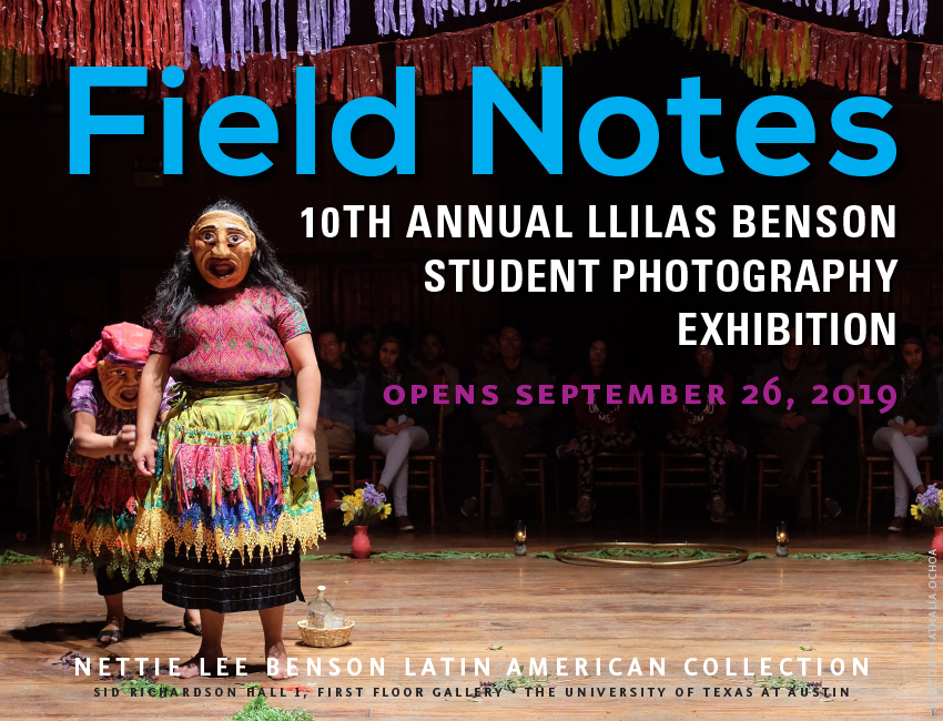
Fall 2019 marks the tenth anniversary of the photography show, originally conceived by Adrian Johnson, librarian for Caribbean studies and head of user services at the Benson. In this Tex Libris post, we give a glimpse of this beautiful and varied exhibition, and invite readers to visit the Benson to view all of the photos.
The announcement for Field Notes 10 used “La limpia,” show in the Field Notes 9 show, and taken in Quetzaltenango, Guatemala, by LLILAS PhD candidate Nathalia Ochoa.
Through her research with Mexican migrants in Austin, prize-winner Maribel Bello created the Facebook page Rancho Querido, which she calls “an emotional-visual-exchange bridge” for sharing of images showing everyday activities in Mexico. Her winning photo shows children playing hide-and-seek. Bello is a master’s student in Latin American Studies at the Teresa Lozano Long Institute of Latin American Studies (LLILAS).
“Yo mejor me escondo,” by Maribel Bello, was taken in La Cueva, Guanajuato, Mexico.
In his untitled prize-winning photo (below), Arisbel López Andraca, a PhD student in the Department of Spanish and Portuguese, depicts a religious procession in Havana, Cuba. López has been researching the visuality of “daily religious practices” in the streets of Havana, noting the considerable increase in the circulation of “dressed dolls” or “spiritual dolls” as representations of orichas, spiritual entities, or eggungun.
“Untitled,” by Arisbel López Andraca, taken in Havana, Cuba, shows a woman carrying a dressed doll in the procession of the Virgen de la Caridad del Cobre.
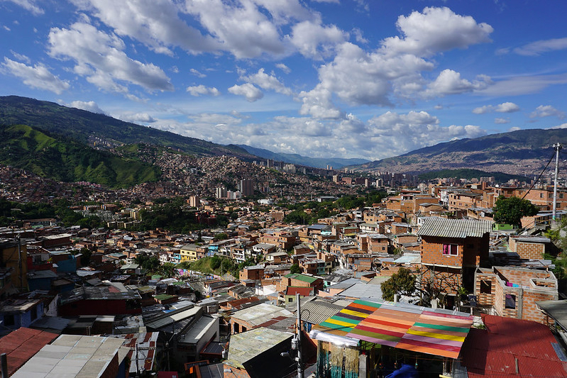
LLILAS PhD candidate Ricardo Velasco looks at “cultural initiatives for memory and reconciliation in the context of Colombia’s current transitional justice conjuncture.” He conducted ethnographic research in Comuna 13, he says, to inquire about “how youth visual culture has contributed to the transformation of what once was one of the urban epicenters of Colombia’s armed conflict.”
“Comuna 13, Medellín,” by Ricardo Velasco. The photo depicts the built environment of Medellín as seen from Comuna 13.
Pablo Millalen Lepin, a LLILAS PhD student, studies public policies toward indigenous people in his native Chile. His photo reflects the meaning of ranching and livestock ownership for Indigenous Mapuche families, for whom “the possession of an animal can be interpreted as part of the local economy, and/or the promise of future work, principally in the area of agriculture.”
“El pequeño toro solitario / The Lonely Little Bull,” by Pablo Millalen Lepin, taken in Lof Mañiuko, a Mapuche community in the South of Chile.
To see and enjoy all of the photographs, visit the exhibition in the first-floor corridor of the Benson Latin American Collection during library hours. Exhibition runs through December 2019.
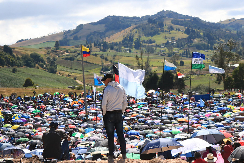
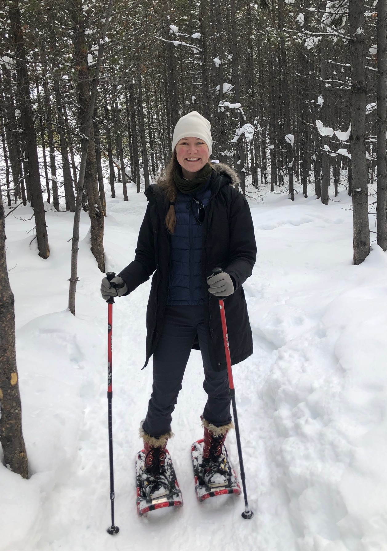
Feature image, top, taken in Boyacá, Colombia, by Sofia Mock, undergraduate in Plan II.
In the same way that the internet and digitization have created new ways to make books more discoverable and facilitated new ways of exploring text, so, too, have they opened avenues for a greater exploration of maps and their underlying data.
As what has been a deliberative process, the UT Libraries have tended toward later adoption of new currents in libraries and librarianship in order to take advantage of the trial and error mechanics that so often are part of embracing untested technologies and frameworks. Geographic information systems (GIS) technology has been in the ascendant for several years now as a burgeoning area of expertise in libraries, and with the expansive cartographic resources we have at UT and the evolution in the growth of local datasets, it was time for the Libraries to embrace GIS as part of its overall strategic expertise.
Geospatial data identifies data that has a geographic component to it…any data that includes locational information – such as coordinates (latitudes and longitudes), addresses, cities, zip codes, etc. – and can be applied to some position on the Earth. We rely on geospatial data to track weather, find the best route to a destination, manage air traffic, make decisions about where to invest in infrastructure projects and to determine how best to deploy marketing resources. And all of these data forms can be mapped. GIS helps to organize and visualize that data in ways that make it eminently more useful.
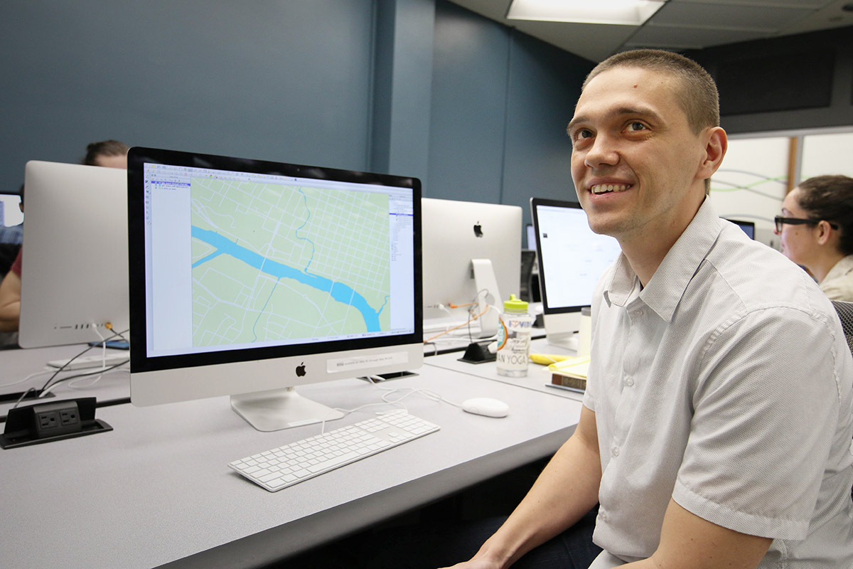
The Libraries finally entered the landscape of GIS last year with the hiring of Geospatial Data Coordinator Michael Shensky, and a major undertaking in his short tenure has been to spearhead the development of an interface that will facilitate discovery of the cartographic resources and geospatial datasets in our collections by researchers, faculty and other university constituents.
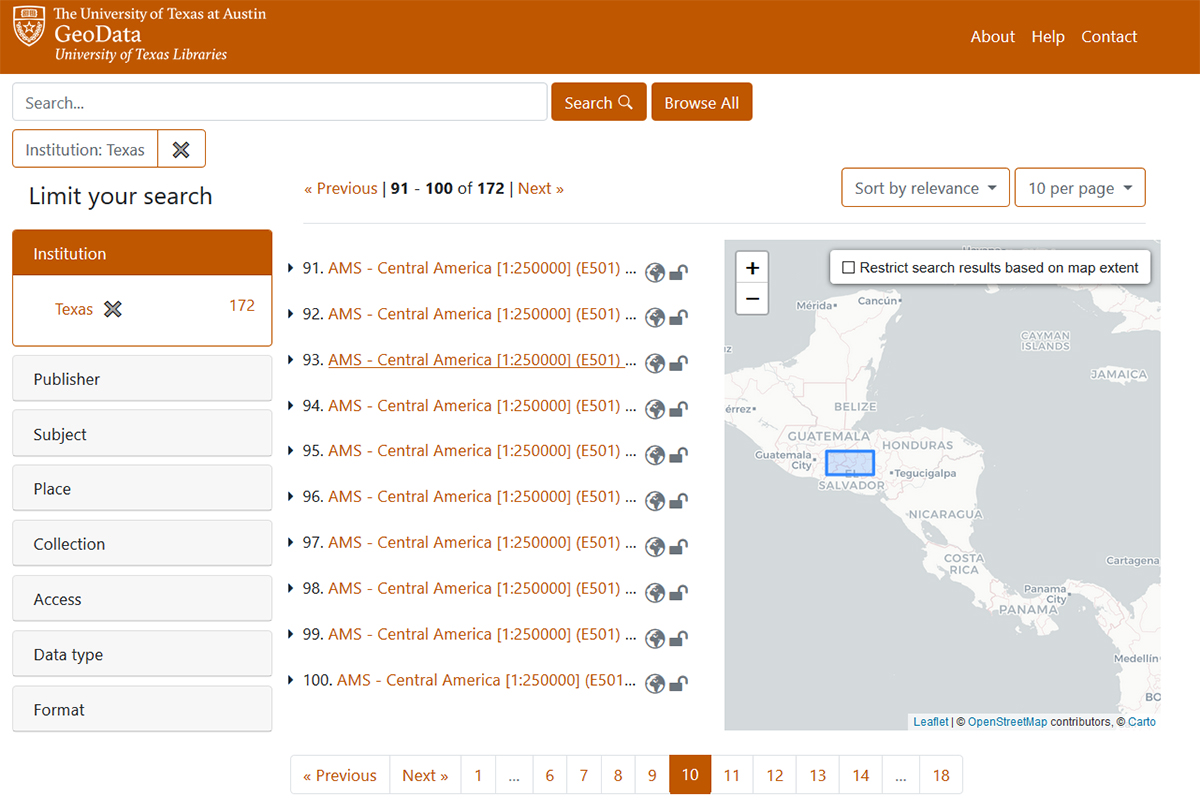
Texas GeoData Portal.
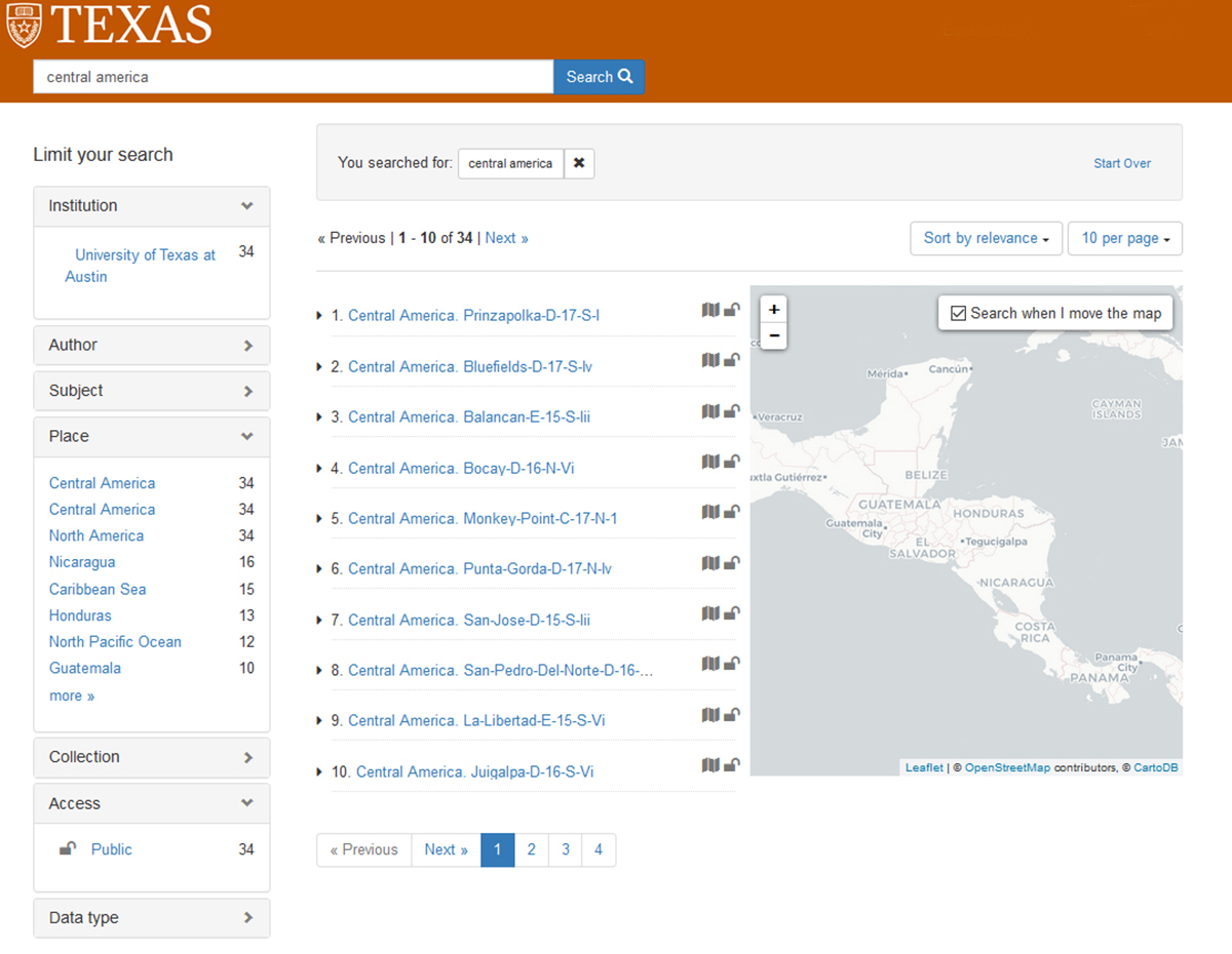
The Texas GeoData Portal uses an open source geospatial discovery application – GeoBlacklight – to power a web portal that gives users the ability to search, browse, preview, and download geospatial datasets. Visitors to the website will be able to search through a variety of geospatial datasets, including georeferenced scanned map images from the PCL Maps Collection and vector datasets developed from items in other special collections like the Benson Latin American Collection and Alexander Architectural Archives.
The portal will allow users to download data in several different standard geospatial formats so that they can easily be loaded into GIS software for advanced visualization and analysis.
Texas GeoData Portal.
Texas GeoData Portal.
Coordinated use of GeoBlacklight software and collaboration through the OpenGeoMetadata project has created a community among partner institutions for the sharing and standardization of data and metadata, expanding the opportunities for discovery and creating a robust search functionality among a large corpus of resources. Users can filter search results based on various dataset characteristics including geographic extent, subject matter, institution, data type, and format.
“I’m really excited to be a part of this project because I know this portal has the potential to benefit everyone in the campus community regardless of their role and area of specialization,” says Shensky. “Faculty can use the portal to find data for developing instructional materials, students can find data to use in research projects, and visitors will have access to a variety of unique maps and datasets that they can explore.”
The Texas GeoData Portal is in the closing stages of development with a full launch expected later in the fall, at which point users will be able to access the new resource through the Libraries’ website. Already discussions are underway regarding future functionality, which could include UT single sign on authentication for viewing license-restricted data, integration with the unified search on the Libraries’ website and integration with the Texas Data Repository and the Collections portal (more information to come on this project).
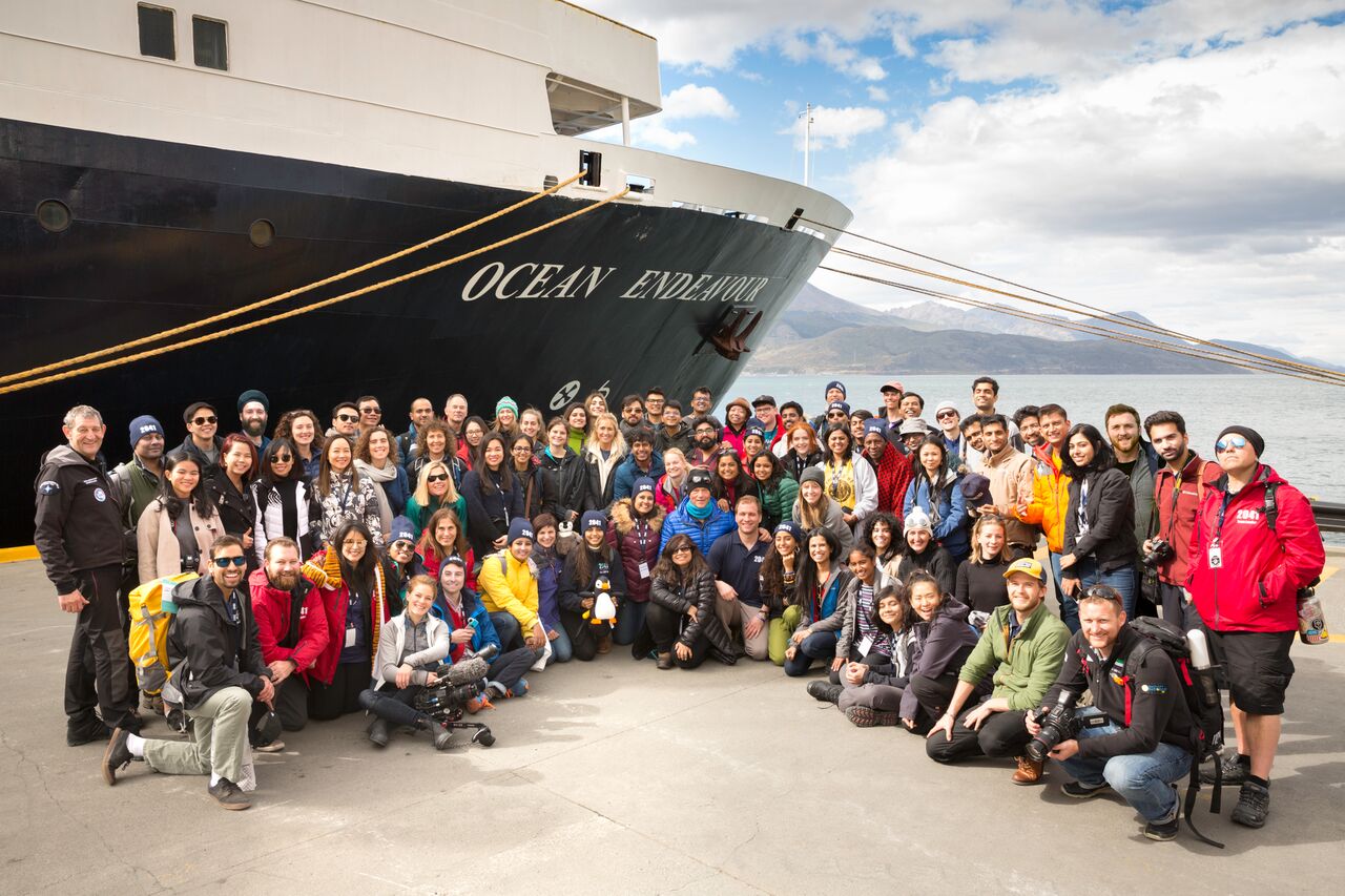
Later this summer, three UT researchers will find themselves in the Arctic. Dr. Emily Beagle, currently a CLIR Postdoctoral Fellow working with Research and Data Services in UT Libraries, will join colleagues from mechanical engineering, Dr. Josh Rhodes and Dr. Todd Davidson aboard the National Geographic Explorer for a 12-day sustainability and leadership training in Svalbard, Norway. The expedition, Climate Force 2019, equips leaders with resources and actionable solutions to fight climate change.
The Expedition will be led by renowned explorer Sir Rob Swan, the first person to walk to both Poles. Over 90 other participants will join them from more than 25 countries with backgrounds in entrepreneurship, sustainability, energy, and education. This is more than just a once-in-a-lifetime opportunity to explore the Arctic. Participants will attend presentations and trainings given by other group members to share expertise, cultivate collaborative relationships and develop actionable solutions for a more sustainable future. Beagle, Rhodes and Davidson will be giving presentations on their energy related research while on the trip.
“We were invited to apply by Sir Rob Swan when he visited UT last year and then had several rounds of application essays and interviews before being formally accepted to the group.” Beagle says. “It’s an honor to have been asked to join such an esteemed and accomplished group of people that make up not only the Expedition leaders but also all the other participants.”
“As engineers and energy experts we will be the ones to develop the solutions needed to solve climate change so it is important for us to be there at the table for these conversations.” Beagle says.
Emily Beagle is a CLIR Fellow in Data Curation for Energy Economics currently in residence at the Libraries.
Michael Shensky joined the Libraries last year as the GIS and Geospatial Data Coordinator to enhance the resources available from the Research Data Services unit with added expertise in Geographic Information Systems, which are increasingly becoming central to our online lives. Shensky took some time to talk about the importance of GIS and where he sees it in the future.
GIS and Geospatial Data Coordinator Michael Shensky.
Michael Shensky: Whenever I’m asked what GIS is, and I often am when I tell people what I do for a living, I always start with a very simple definition and expand from there. I typically tell people that GIS is an acronym that stands for geographic information systems and that it is the technology that is used to manage the data behind many of the maps they encounter online and in mobile apps. I also find it helpful to explain that the “geographic information” part of GIS refers to geospatial data (data that features both coordinate information identifying a place on Earth and attribute information that describes something located at that place) while “system” refers to the software and hardware components that are used together to manage this unique type of data effectively.
GIS is incredibly important in our daily lives because it is used to guide and facilitate much of the work that local governments, state and federal government agencies, utility companies, non-profit organizations, and academic researchers carry out. If all GIS software were to suddenly stop working tomorrow, it would be very difficult for those who rely on geospatial data to effectively manage their operations and this would have a dramatic impact on the lives of everyone, not just GIS users. For instance, cities might have difficulty assigning work crews to conduct road repair work if they cannot access their database of pothole locations, fire departments might struggle to respond to the locations of emergencies if they can’t quickly look up the location of an address, and technology companies would see apps that include mapping functionality suddenly break as the data fails to load properly.
While most people do not realize the significant role that GIS software plays behind the scenes in the operations of many organizations, if they look closely enough they can find traces of its impact in their daily lives. If they come across a map when browsing the web, there is a very good chance that GIS software was used to design its layout and manage the data behind the features depicted in it. If a new store or restaurant opens in their neighborhood, it is likely that GIS software was used to analyze demographic and consumer spending data for their local area to determine that this would likely be the most profitable location. If they use the routing functionality built into their car dashboard, the street data used to route them was likely created or edited with GIS software. If they visit the website of their local city or county, it is quite likely they will find a web page designed specifically for sharing geospatial data that has been developed with their taxpayer money and which has been made publically available for anyone to download and use in GIS software.
Given the organic nature of its development, how can standards be developed to manage the proliferation of GIS data?
MS: In the GIS world, there are open standards developed by non-profit organizations like the Open Geospatial Consortium (OGC) and there are often competing proprietary standards developed by for-profit companies like Esri, whose software products dominate the GIS industry in the United States and many other countries. While we are very fortunate that these standards exist so that there is agreement on how data should be structured and how it should be read by GIS software, there are downsides to having multiple standards to choose from. Having multiple standards to choose from puts GIS professionals in a tough position when we want to share data with others, since we often need to ensure that data is available in multiple standard formats to make it easy for other GIS users to work with the data regardless of whether they are using open source software or Esri’s ArcGIS software. This situation is further complicated by the fact that the popularity of specific standards can fluctuate over time and occasionally completely new standards are developed while older standards may fall into disuse and become functionally obsolete.
For the geospatial data in the UT Libraries’ collections that we are currently in the process of trying to make more easily accessible, we are aiming to share the data in every common standard format that we can. Our goal is to facilitate access to our data for all GIS users, regardless of which software they use or standards they prefer. This approach of making shared datasets available in multiple formats has become quite common on data portals operated by other universities as well as those developed by cities, counties, and federal government agencies. As any good organization would, we plan to stay on top of the latest geospatial data standards and ensure that we are making datasets available in the formats that GIS users expect to find and like to work with.
How did you become a specialist in GIS?
MS: That’s actually a really interesting question, because I sometimes look back on the last decade and wonder that myself. The career path I envisioned for myself shifted quite a bit during my college years and a few chance decisions that didn’t seem particularly significant at the time ended up playing a very substantial role in leading me to the position I’m in today.
As a junior, I was contemplating my changing my major to anthropology or geography since I had really enjoyed taking classes in both disciplines, and I ended up selecting geography partly because I knew that GIS was a required class in that program and that this class would provide me with a technical skill upon graduation. At the time, I had never used or even seen GIS software but I knew it was used to make maps and that sounded really interesting to me. I didn’t actually end up taking that required GIS class until my last semester as an undergraduate and I did I was a surprised to find it a little less exciting and more challenging than I had originally expected. Right after graduation I started applying for a variety of jobs that I thought I might qualify for and the first one I was offered was a paid GIS internship. I didn’t find the job all that interesting at first and during my first few months there did not see myself making a career out of GIS.
This initial lack of fulfillment actually even ended up being a contributing factor in my decision to enroll in a Geography graduate program – I wanted to develop new skills that would open up different job opportunities. While in grad school I continued to work at this same GIS job part time and found that I started to become more interested in the work I was doing as I was assigned more advanced and challenging projects. Because of the GIS skills I gained in this role, I was offered a GIS research assistant position during my last two years of graduate school and then ended developing my master’s thesis project from the work that I did in this role. By the time I completed the work for my master’s degree, my perspective on GIS had changed dramatically, and when I was offered a full time job teaching GIS classes and managing the GIS computers labs for the Geography department at California State University, Long Beach, I was thrilled to have the opportunity to advance my career in GIS. I ended up spending several years in this position which allowed me to further develop my technical skills, gain teaching experience, and develop an even greater respect for the value of GIS software in academic research – all of which prepared me for well for my current role here at the UT Libraries.
What sort of projects have you been working on at UT?
MS: I’ve been working on a few different projects since I started here at UT, the biggest of which is focused on developing a new geospatial data portal that will be part of the UT Libraries website. This portal will allow users to search for geospatial data in our Libraries’ collections that can be used with GIS software. We have been referring to this project internally as the “GeoBlacklight” project because it uses open source software of that name to provide a web interface and data search capabilities. We are optimistic that this project will be completed in the first half of 2019 and that it will be available to the campus community before the start of the fall semester. Once it is rolled out, visitors to the website will be able to search through a variety of geospatial datasets including georeferenced scanned map images from our PCL Map Collection and vector datasets developed from items in other collections like the Benson Latin American Collection and Alexander Architectural Archives. I’m really excited to be a part of this project because I know this portal has the potential to benefit everyone in the campus community regardless of their role and area of specialization. Once the portal is finished and made available, it should be easy for faculty to find data that they can use to develop instructional materials, for students to find data they can use in research projects, for Libraries staff to find data they can use to highlight notable collections, and for everyone in general to browse through when curious about the interesting maps and datasets we have available here at the UT Libraries.
San Salvador map from the PCL Map Collection.
Screenshot of the search results page in a still-under-development version of the UT Libraries GeoBlacklight portal.
addition to the GeoBlacklight project I have also been working on a program of coordinated outreach and education about GIS both internally within the libraries and externally with departments across campus. As part of this effort I have helped organize events like our recent Local Perspectives on the State of Open Data discussion panel which brought GIS experts from the City of Austin, Travis County, Texas General Land Office, and Texas Natural Resources Information System here to campus to share their thoughts on GIS and open data. I’ve also taught several GIS focused workshops that provided an opportunity for all members of the campus community to learn about GIS and further develop their geospatial research skills. In order to introduce library personnel to some of the capabilities of GIS I’ve also spoken at and helped organize a series of linked data information learning group meetings. I’ve been glad to see that this multifaceted approach has been successful in helping get the word out about GIS on campus and I’ve noticed that I am starting to hear from more and more people each week who are looking to learn more about how they might be able to use GIS in their work.
What are some of the interesting ways GIS will be used in the future?
MS: While it’s impossible to know exactly how the way in which we use GIS might change in the future, I think there are a few developments that are all but certain. One of the major developments I foresee is growing awareness of GIS and rapid improvement in the capabilities of open source GIS software like QGIS leading to greater adoption of GIS software in a variety of disciplines and industries. If this prediction proves accurate, the lowering of financial and technical barriers that currently hold people back from using GIS software would greatly benefit small businesses, startups, non-profits, municipalities with limited resources, and more. It should also have a profound impact in the academic world as it will make it easier for researchers to incorporate GIS into their work. I think we will see GIS software being used much more widely in fields like history, journalism, linguistics, ethnic studies, and in the humanities more generally. If this does in fact happen, it will not only open up new avenues for research in these fields but will also make it easier for those working in these different disciplines to work together with each other across departments because they are using a shared technology. Even in disciplines where GIS is already widely used, like geology, biology, geography, and anthropology, I think there will be increased rates of adoption, especially among researchers in developing countries who can start using open source GIS software without having to worry about expensive software licensing or significant software limitations. From my experience in a previous GIS position at another university, I saw firsthand how difficult it could be for researchers in my department to work with colleagues from universities in other countries whose institutions could not afford access to the same proprietary software resources until they all started using open source software to facilitate collaboration.
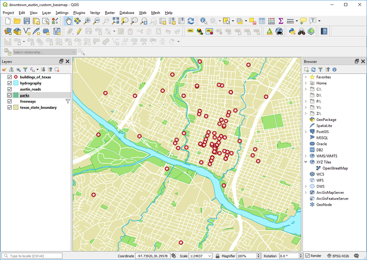
Example of a QGIS project.
In addition to the many benefits I think we will see from growing awareness of GIS software and open source GIS software in particular, I think GIS technology will become more useful and powerful as technology continues to improve. Perhaps the biggest impact on GIS will come from new and emerging categories of mobile devices that will make it possible to view and interact with geospatial data in ways that are quite different from the manner in which we engage with geospatial data now on the flat screens of our computer monitors and cell phones. In the 9 years that I have been in this field, there have been several completely new categories of devices that have been released (smart watches, augmented reality glasses, and virtual reality headsets being the most notable) all of which can be used to display new types of maps and I think we will see these technologies mature in a way that will affect how maps are made.
Virtual reality is the currently the most significant of these technologies for working with geospatial data due to the availability of relatively affordable consumer grade headsets and their ability to give users a three dimensional immersive map experience. While I think virtual reality maps will become increasingly common and useful, I think augmented reality devices ultimately hold the most promise of any emerging technology. Right now augmented reality glasses are held back by their high price points, large size, and limited field of view but companies like Microsoft, Google, and Apple have all indicated that they are working on addressing these challenges. If any of these companies (or newer companies like Magic Leap who are also focusing on augmented reality technology) can create a wearable device similar in size to a pair of regular sunglasses, sell it for close to the price of a high end cell phone, and have it effectively overlay 3D objects on top of a user’s normal field of view, I think this would revolutionize how GIS professionals manage data and produce maps. It would also of course open up enormous opportunities for researchers who are looking for new ways to explore geospatial data and visualize their research findings. While a breakthrough like this may not happen this year or next, I think it is just a matter of time before our technology reaches this point and GIS software will have to adapt to facilitate the production of geospatial content for these new types of devices.
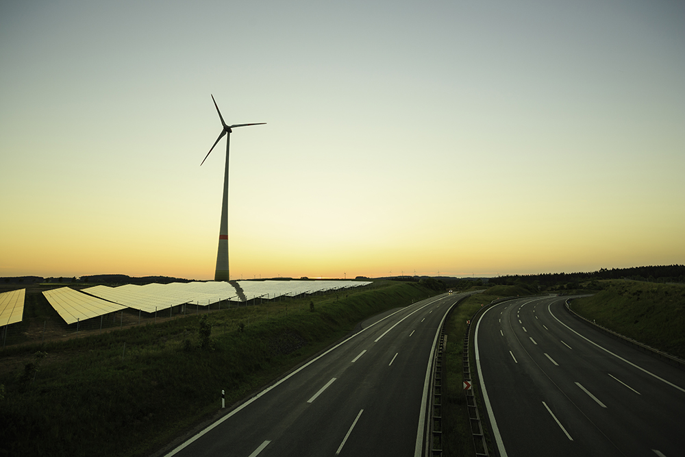
If you’ve spent much time in the past decade or so traveling in Texas, you might have noticed the increasing ubiquity of wind farms cropping up along spartan stretches of highway across the state. If a new project involving a fellowship recipient in residence at the Libraries holds any promise, you might soon see more solar panels along your travels, as well.
Emily Beagle.
Last August, the university welcomed a new Council on Library and Information Resources (CLIR) fellow, Emily Beagle, who spent the fall splitting time between the Research Support & Digital Initiatives at the Libraries and the Webber Energy Group in the Mechanical Engineering Department. Beagle was one of a group of four cohorts in a Data Curation for Energy Economics track for CLIR who are working at various energy institutes and libraries across the country. Beagle’s specific project work throughout the fall related to a renewable energy project funded through The Ray (at The Ray C. Anderson Foundation in Georgia) — one that could potentially bring solar power generation to those long stretches of Texas highway.
The Ray began as a project specific to an 18-mile stretch of I-85 southwest of Atlanta as an exploration of ways “to create a regenerative highway ecosystem” through a reconsideration of the land and communities surrounding our collective highway system. The Ray has already deployed several pilot technology projects along the route including solar-powered vehicle charging, a tire safety check station and solar-paved highways, and the component of the project tasked to the Webber Group was to investigate the placement of solar photovoltaic panels along the right-of-ways nationwide to provide additional energy to the power grid. To do so, the group had to consider the over 45,000 miles of roadways that make up the U.S. interstate network.
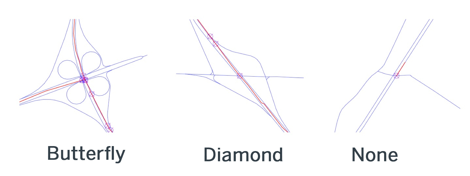
Interchange types.
Narrowing the scope down to a manageable sampling required the research group to come up with some exclusionary criteria, removing swaths from consideration like protected areas (e.g. National Parks and Forests), and focusing on locations close to existing transmission lines, adjacent spaces that are large enough to accommodate development, and locations near exits to make them easy for maintenance access. This allowed them to use existing environmental data for the available space to determine where voltaic clusters would be most efficient and effective.
The Webber Group’s work on The Ray project began in March before Beagle arrived, but that worked out well for her contribution to the project, which involved the development of a data management plan, prepping data for sharing and preservation in repositories like Texas ScholarWorks, and validating reproducibility in findings. She has worked closely with Libraries colleagues to develop and implement the data plans for the group, while also providing ongoing assessment of the process and the effectiveness of Libraries’ tools and resources as an embedded member of the project team.
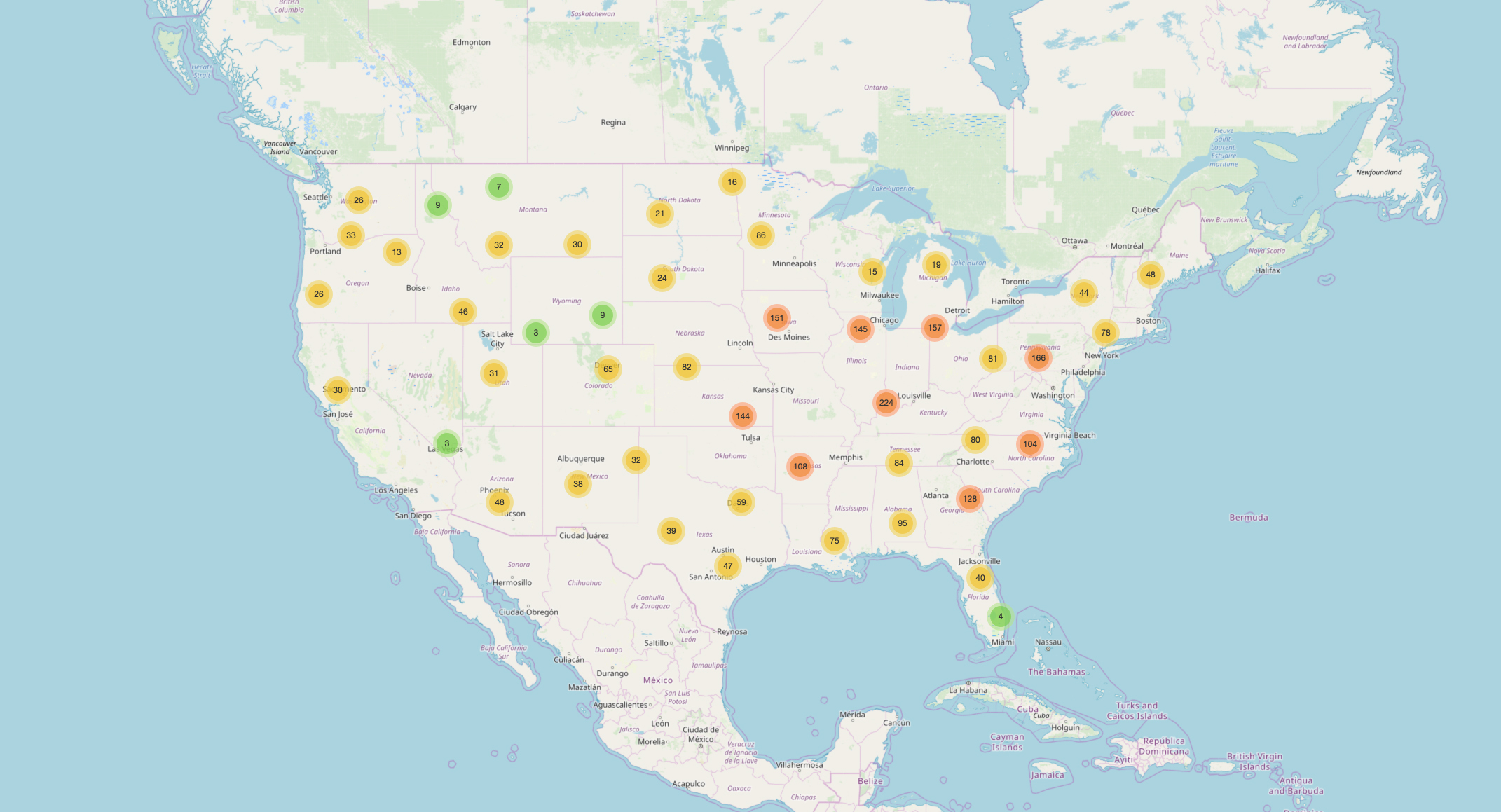
Solar Potential Map developed by the Webber Energy Group.
Working throughout the fall, the group was able to create a report for the foundation in December, and develop an online tool — the Solar Potential Map — that shows the best options for locating panel installations along roadways across the U.S. With the potential for a significant national infrastructure investment under discussion, components conceptualized through a project like The Ray could eventually become a reality. The Ray has already piloted one cluster of solar panels along I-85, and now they have the data to support an expansion of the idea on a much larger scale.
Beagle will continue her stint as a CLIR fellow through the spring, coordinating with her peers in Mechanical Engineering to supervise graduate student work on data-intensive research projects and use that interface to inform and develop data management resources and services at the Libraries. She’ll also using the knowledge she’s gained from the fellowship residence to co-teach workshops for other researchers on campus.
She isn’t the first CLIR fellow the Libraries have hosted — there are currently two Postdoctoral Fellows for Data Curation in Latin American and Latina/o Studies at the Benson Latin American Collection: Edward Shore (continuing from 2017) is overseeing a project to preserve and digitize rare historical documentation on quilombos, communities organized by fugitive slaves in colonial Brazil, and Jennifer Isasi (2018) is working with Benson Digital Scholarship Coordinator Albert A. Palacios to contribute to collections as data efforts, educational resources and digital scholarship initiatives at LLILAS Benson Latin American Studies and Collections. And 2017 fellow at the Benson, Hannah Alpert-Abrams, recently completed her term working to develop the repository and interface for the digital Archivo Histórico de la Policía Nacional, a collection of records relating to the national police of Guatemala. 2013 CLIR Postdoctoral Fellow for Data Curation in Medieval Studies Ece Turnator took part in a collaborative bid between the Libraries, the English Department and research units on campus — including the Texas Advanced Computing Center — to create a global gateway to all the digital resources currently available on the Middle Ages, the Global Middle Ages Project (G-MAP).
“The CLIR program has been of great value to the Libraries by allowing us access to trained scholars and researchers with perspectives informed by current trends in the interrelationship between libraries and community stakeholders,” says Vice Provost Lorraine Haricombe. “Their presence provides an opportunity to bridge between unit-level research and scholarship and library resources and services, and to use that bridge to improve and elevatewhat we do.”
The CLIR Postdoctoral Fellowship Program offers recent Ph.D. graduates the chance to help develop research tools, resources, and services while exploring new career opportunities. Host institutions benefit from fellows’ field-specific expertise by gaining insights into their collections’ potential uses and users, scholarly information behaviors and current teaching and learning practices within particular disciplines.
Beagle says the fellowship experience so far has played out as advertised, but in unexpected ways.
“Being split between Engineering and the Libraries, I was expecting that my duties for both would be very different and not have much overlap,” she says. “But I have been pleasantly surprised at how much I have been able to collaborate between the two groups and how much work in one area has informed a project in the other.”
“It has been very rewarding to work with the Webber Energy Group, UT Libraries and The Ray on a project with real world applicability. I hope to someday see solar panels along the interstate and be able to think ‘I was a part of that.’”
Read, hot & digitized: Librarians and the digital scholarship they love — In this series, librarians from UTL’s Arts, Humanities and Global Studies Engagement Team briefly present, explore and critique existing examples of digital scholarship. Our hope is that these monthly reviews will inspire critical reflection of and future creative contributions to the growing fields of digital scholarship.
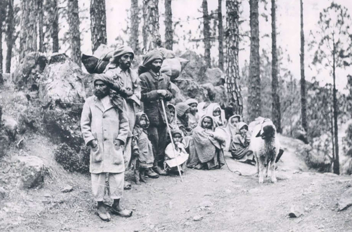
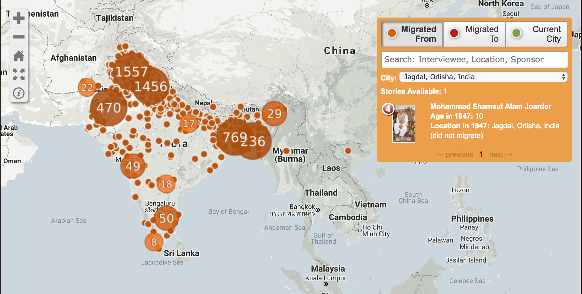
Increasingly simple and cost-effective digital technologies have made capturing and distributing oral histories a robust and growing field for archivists and for researchers, and, by extension for students and scholars seeking primary source, personal narratives to augment their understandings of history. One of the most compelling South Asian oral history projects is the 1947 Partition Archive. The Archive’s mission is to preserve eyewitness accounts from those who lived through the exceptionally turbulent and violent period when the Indian subcontinent gained independence from Britain, divided into the nation-states of India and Pakistan, and millions of people migrated from India to Pakistan, from Pakistan to India, from India and Pakistan to other parts of the world. The work of the Archive is especially pressing: it has been 72 years since Partition and those still alive and able to directly recount their stories are increasingly rare. As such, the core of the Archive’s work is to use its digital platform to encourage and motivate more interviews.
Using the power of “the crowd” to create content as well as to fund itself, the 1947 Partition Archive is demonstrably transparent in its methodologies; of particular use to those new to video oral histories is their “Citizen Historian Training Packet” which walks a novice through best practices for interviewing, strategies for good video capture, recommendations for incorporating still images into videos and even how to employ social media to generate interest (and potentially more interviews!). The Archive has gathered over 5000 interviews so far and uses a very persuasive interactive map (StoryMap) on its front page to document the scale and scope of migration while simultaneously indexing the interviews; on the map itself, try searching a city either in “migrated to” or “migrated from” to generate a list of interviews, many with detailed text summaries that can be easily shared through social media, email, etc.
A handful of video interviews are available on the front page of the Archive’s website and raw, unedited recordings are available upon request.
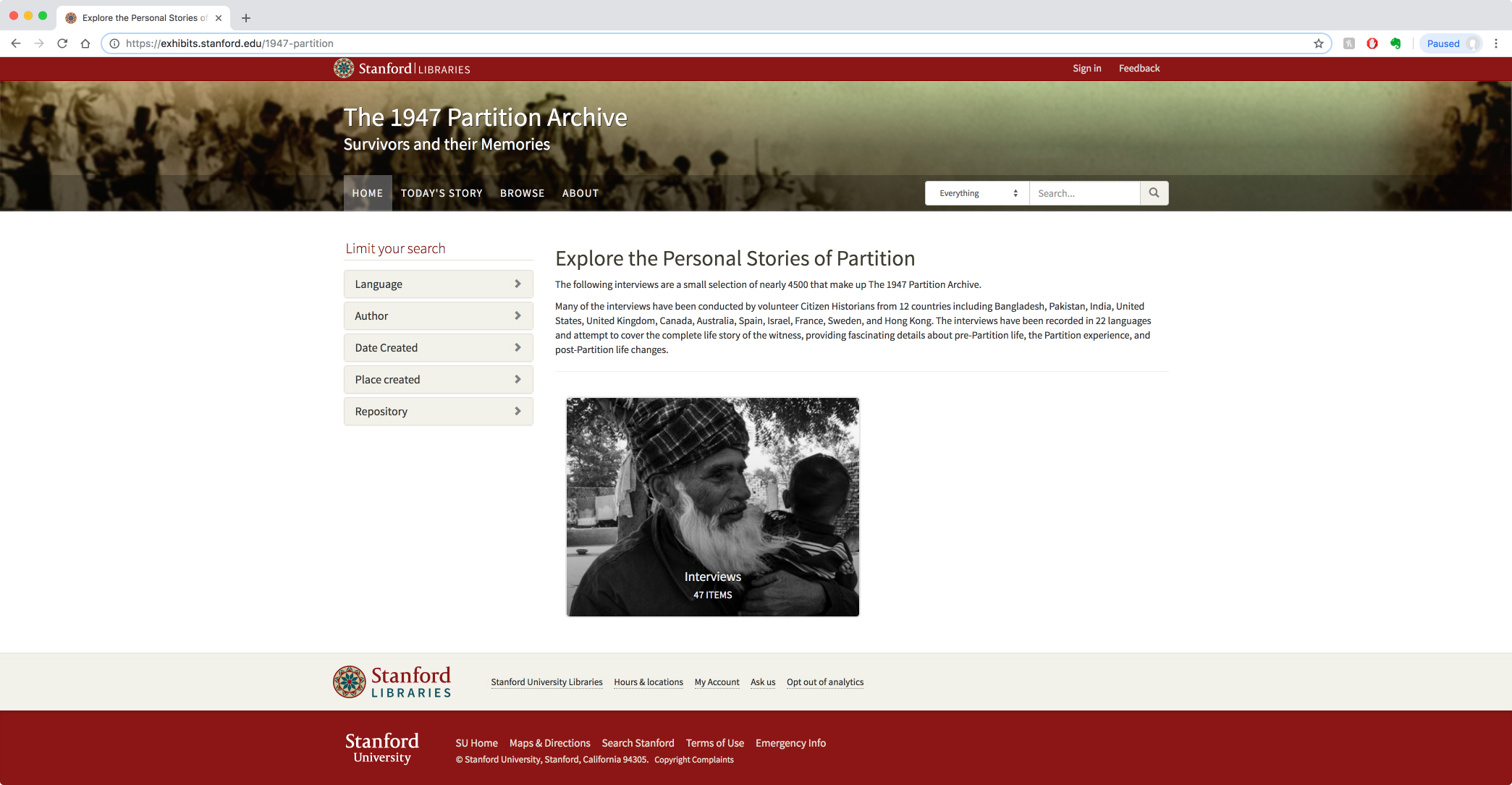
Recently the Archive has partnered with Stanford University Library to preserve and archive the recordings. To date, approximately 50 interviews are available through streaming on the site and (contingent on funding) one can hope for more to be available soon. On the Stanford site, one can navigate by language, author, place & date of recording, but those just beginning to explore the subject may find the “Today’s Story” a good place to start.
The stories bravely shared through the 1947 Partition Archive are simultaneously compelling and devastating in their intimate descriptions of destruction, of violence, of loss. And yet, they also provide hope: all interviewees survived the ruin that was Partition and the very act of sharing their stories demonstrates a hope for and generosity towards future generations to learn from the past.
The North American Taiwan Studies Association (NATSA) Annual conference was held at UT on May 24-26, 2018, the third time in Austin since its inauguration in 1994 (previously 1998/2009/2018), reflecting the strong interest in Taiwan Studies at the University of Texas in Austin.
This year, the theme of the conference was “Beyond an Island: Taiwan in Comparative Perspective.” Thirty invited scholars, sixty presenters and thirty NATSA staff gathered on campus to discuss their research on Taiwan. Despite the tight schedule, a number of the international participants were able to join Meng-fen Su, East Asian Studies Liaison Librarian, for a library tour of PCL, during which they shared their admiration for the library’s rich collection and innovative use of spaces.
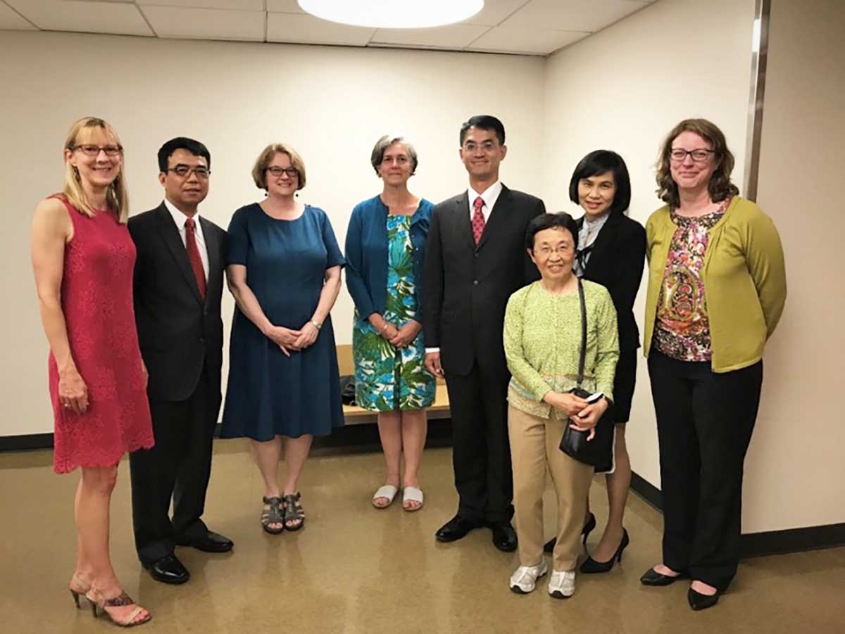
As one of the funding sponsors, many of TECO Houston (Taipei Economic and Cultural Office in Houston which functions like Taiwan’s consulate Office in Houston) officers also attended the conference. Meng-fen Su was contacted early in the planning so that TECO could donate a collection of books to the University of Texas Libraries and so that a book donation ceremony could be held during the NATSA Conference Welcome Ceremony. Five librarians from UT Libraries attended the ceremony and Catherine Hamer, Director of Academic Engagement, received the books on behalf of the library.
Catherine Hamer received a representative pack of donated books from Peter Chen, Director General of TECO, Houston.
UTL librarians with TECO representatives, including Ms. Sophie Chou, Director of Education Division (right 2nd), Mr. Peter Chen, Director General (right 4) and Mr. Yintso Lin, Deputy Director General (left 2).
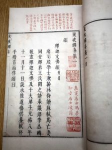
The books donated by TECO are primarily books by or about Su Shi (or Su Shih in Wade-Giles romanization, 蘇軾 / 苏轼 in traditional / simplified Chinese scripts, 1037-1101) who is better known by his literary name: Su Dongpo (or Su Tung-p’o in Wade-Giles romanization, 蘇東坡/苏东坡), who was “unquestionably one of the most extraordinary men ever to grace the world of Chinese arts and letters.” (from Beata Grant’s Prologue to her Mount Lu Revisited: Buddhism in the life and writings of Su Shih). Su Dongpo was also a major political figure of his time, not to mention a painter, calligrapher, Buddhist, philosopher, classicist and connoisseur of the arts. The TECO donation includes 93 Taiwan publications of contemporary writings about Su Dongpo and 31 facsimiles of rare fine editions of books related to Su Dongpo, produced from the collection of National Central Library (Taiwan).
Texas ScholarWorks (formerly the University of Texas Digital Repository) went into production in September 2008. Texas ScholarWorks (TSW) was created to provide open, online access to the products of the University’s research and scholarship, preserve these works for future generations, promote new models of scholarly communication and deepen community understanding of the value of higher education. In honor of our first 10 years, we’d like to share some samples of the kinds of important work being shared in TSW.
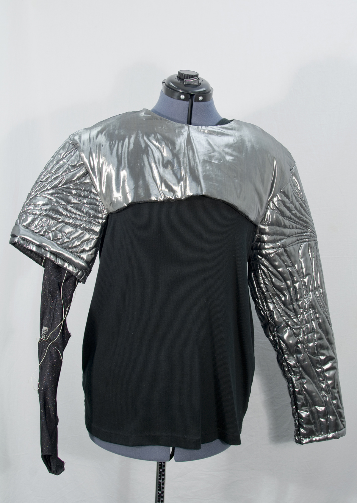
A wearable technology costume from the Sharir Collection (photo by Mark Doroba)
Dance professor, Yacov Sharir, has donated his archive of videos and documents related to performances, rehearsals, workshops and events that span his four decade career at UT. UT Libraries digitized the contents of this collection and worked with Dr. Sharir, Beth Kerr, and Katie Van Winkle to describe the materials. The resulting collection in TSW is a treasure trove of information about the dance community in Austin.
UT Communications professor, Robert Hopper (1945-1998), recorded thousands of hours of everyday conversations between people over the phone, in recorded messages, and in person. Approximately 200 hours of those recordings, and their associated transcripts, are available in TSW. This is a unique collection for those who study spoken language.
The Center for Electromechanics (CEM) has chosen to share their conference proceedings, publications, and reports via Texas ScholarWorks. CEM is a leading applied research unit on campus and their researchers are recognized experts in advanced energy storage and power generation rotating machines for both intermittent and continuous duty applications.
Waller Creek, a tributary of the Colorado River, goes through the UT campus and is a focus of research for people at UT and in the Austin community. In an effort to improve the efficiency of finding information about Waller Creek, researchers have chosen to use Texas ScholarWorks as an archive for the publications, data, maps, images and class projects about the creek.
Before his death in 2006, club owner and Austin music scene icon Clifford Antone brought his vast knowledge of music — more specifically the blues and rock and roll — to the Forty Acres for a lecture series hosted by the Department of Sociology called “The History of the Blues According to Clifford Antone.” The series of lectures was recorded and resides both in the collection of the Fine Arts Library and online at Texas ScholarWorks.
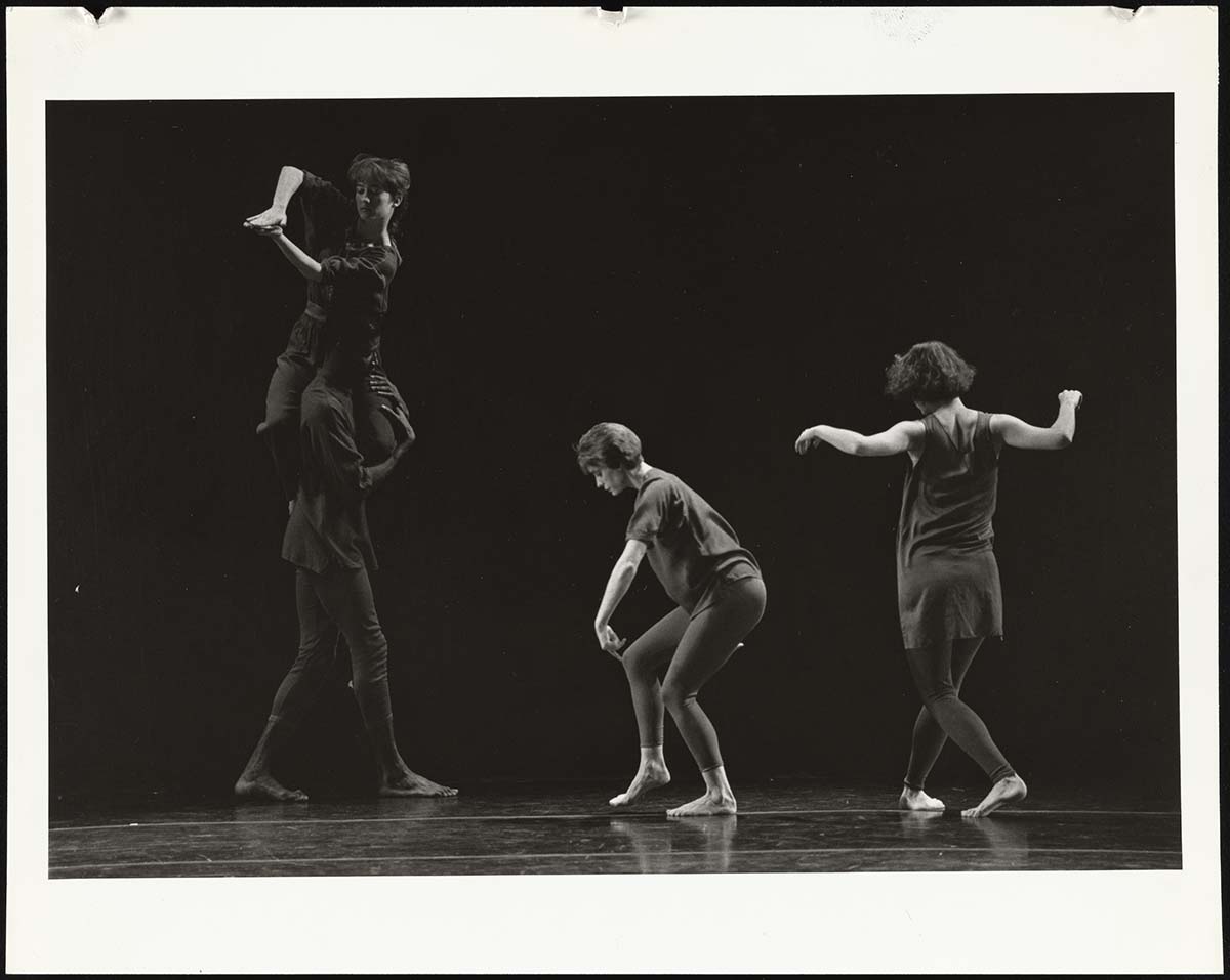
Photograph from the Sharir Collection taken between 1980-1996.
The process of making content available in TSW is a team project and has been from the start. The launch of TSW was the work of Project Institutional Repository Implementation (IRI) which started in early 2008. Over the course of approximately one year, the Project IRI team contributed 4,505 hours of work towards the launch and promotion of TSW. At the conclusion of the project in January 2009 there were 5,961 items in TSW. Today we have over 58,000 items. You can find documentation from Project IRI in TSW.
Many thanks to the Project IRI team, current UT Libraries staff working on TSW, and our partners at Texas Digital Library.
LLILAS Benson Latin American Studies and Collections is pleased to announce that Jennifer Isasi, PhD, will join the staff as CLIR Fellow for Data Curation in Latin American and Latina/o Studies. Isasi will work with Digital Scholarship Coordinator Albert A. Palacios to contribute to “collections as data” efforts, educational resources, and digital scholarship initiatives at LLILAS Benson. She will hold her position from July 29 through June 2020.
In her role as CLIR fellow, Isasi will have the opportunity to alter the way in which students, researchers, and affiliated communities access and engage with the digitized historical record.
According to CLIR (the Council on Library and Information Resources) the CLIR postdoctoral position “offers recent PhD graduates the chance to develop research tools, resources, and services while exploring new career opportunities. . . . Fellows work on projects that forge and strengthen connections among library collections, educational technologies, and current research.”
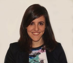
Jennifer Isasi
In addition to her work with Palacios, Isasi will work closely with the current CLIR fellow Hannah Alpert-Abrams as well as University of Texas Libraries academic engagement staff and LLILAS affiliated faculty to develop curated data sets, curricula, and workshops centered on digital assets and tools, and open-access resources that support scholarly and public engagement with digital materials.
Isasi will also work closely with the post-custodial archival team and partners in the United States and Latin America to inform the development of forthcoming digital collections and facilitate their use in digital research and pedagogy. As such, she will have the opportunity to alter the way in which students, researchers, and affiliated communities access and engage with the digitized historical record.
Jennifer Isasi holds a PhD in Hispanic Studies with a specialization in Digital Humanities from the University of Nebraska-Lincoln. Her dissertation, “Data Mining Possibilities for the Analysis of the Literary Character in the Spanish Novel: The Case of Galdós and the ‘Episodios nacionales’” (written in Spanish) establishes a computational reading methodology to extract, analyze, and visualize literary character-systems or social networks, noting how they reflect novel genres and degrees of historicity that replicate close readings of the novels. Currently, she is a lecturer of Spanish at the University of Nebraska at Kearney, where she teaches Spanish, Commercial Spanish, and Foundations of Literacy.
The mission of UT Libraries is to “advance teaching, fuel research and energize learning through expansive collections and digital content, innovative services, programs and partnerships to develop critical thinkers and global citizens that transforms lives.” In recent years, our mission is fulfilled through a number of ongoing thematic “Purposeful Pathways” and short-term focused “Current Priorities.” In this blogpost, I would like to highlight how my recent efforts in Pakistan demonstrate the realization of a number of our pathways and priorities, namely those related to collections of distinction, collaborative collection development programs, and visibility and impact in the global knowledge ecosystem.
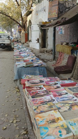
Book stall.
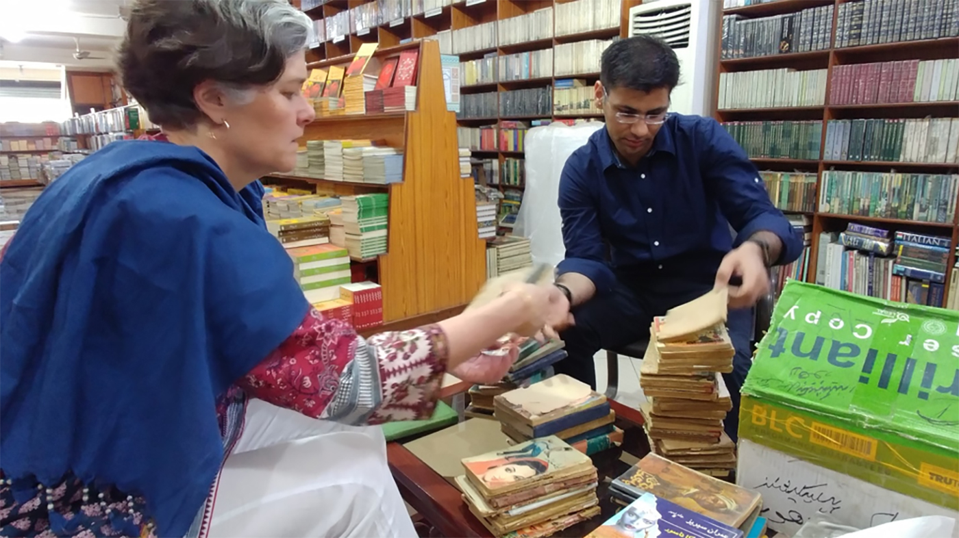
I have written before about UT’s maturing South Asian Popular and Pulp Fiction Collection, both in terms of its growth and in terms its relationship to the national distributed collection for South Asian Studies as supported through the South Asian Cooperative Collection Development Workshops. With my 2018 trip, I was able to expand the collection’s Pakistani imprints considerably. For a number of years, we have been working to establish UT’s collection of novels by Ibne Safi as one of, if not the, largest in the world. While in Pakistan, I was able to meet and work with Ali Kamran, the Managing Director of Sang-e-meel, one of our major vendors, to review and purchase both currently produced Ibne Safi titles as well as out-of-print editions–the former we were able to explore in his office itself, the latter we explored on foot in the second-hand markets of Lahore. I am excited to receive the new additions soon and to add them to our collection, including that which is represented online and described in a compelling new exhibit by UT iSchool student Nicole Marino.
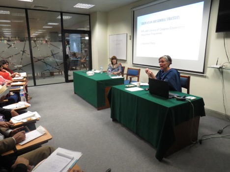
Speaking in Lahore.
While in Lahore, I partnered with my colleague from Cornell University Libraries, Dr. Bronwen Bledsoe, to co-lead a workshop for librarians. The 2-day workshop was sponsored by the Lahore University of Management Sciences (most commonly known as ‘LUMS’) and by the American Institute of Pakistan Studies (known as ‘AIPS,’). Entitled “Exploring Library Cooperation,” the workshop focused on themes of how to identify opportunities for and strategies to work across institutions to improve access to resources and services.
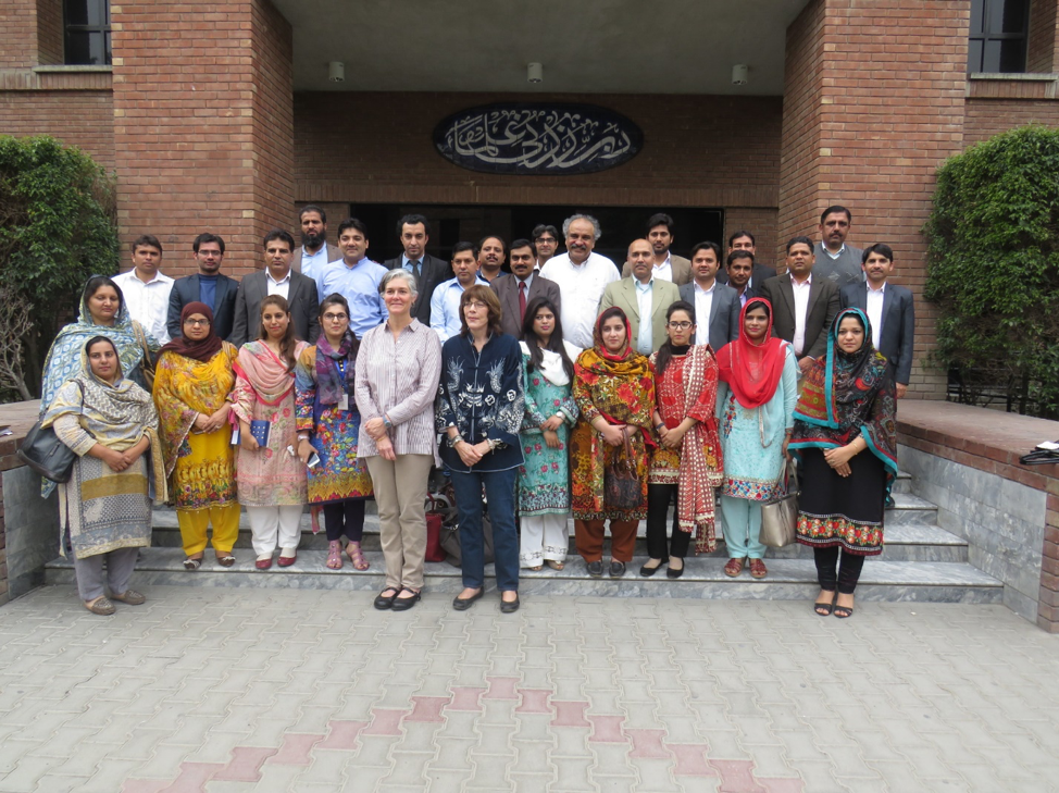
Librarians in Lahore.
Approximately 30 librarians from across Lahore attended, including those from LUMS, Punjab University, Government College University, Kinnaird College for Women, and the Government of Punjab Research Wing. While our opportunities for collaboration here in the U.S. are deeply embedded in our ongoing work (not only efforts such as the South Asia Cooperative Collection Development Workshops noted above but also structural support such as our robust InterLibrary Services), it was clear from our workshop that our colleagues in Lahore are also interested in working together. For example, they shared details of their work to more fully describe and digitize their collections, to collectively petition funding agencies to advance their missions, and to continue developing professional networks and strategies for the common good. I was impressed and inspired by their commitment and enthusiasm and am looking forward to growing these newly formed professional relationships long into the future.
UTL’s Director, Lorraine Haricombe, often cites this maxim: “Working alone, I can go fast, but working together, we can go farther.” I am excited and committed to continuing to work in cooperative ways and have already seen how far it can take us—at least halfway around the world!