
In the same way that the internet and digitization have created new ways to make books more discoverable and facilitated new ways of exploring text, so, too, have they opened avenues for a greater exploration of maps and their underlying data.
As what has been a deliberative process, the UT Libraries have tended toward later adoption of new currents in libraries and librarianship in order to take advantage of the trial and error mechanics that so often are part of embracing untested technologies and frameworks. Geographic information systems (GIS) technology has been in the ascendant for several years now as a burgeoning area of expertise in libraries, and with the expansive cartographic resources we have at UT and the evolution in the growth of local datasets, it was time for the Libraries to embrace GIS as part of its overall strategic expertise.
Geospatial data identifies data that has a geographic component to it…any data that includes locational information – such as coordinates (latitudes and longitudes), addresses, cities, zip codes, etc. – and can be applied to some position on the Earth. We rely on geospatial data to track weather, find the best route to a destination, manage air traffic, make decisions about where to invest in infrastructure projects and to determine how best to deploy marketing resources. And all of these data forms can be mapped. GIS helps to organize and visualize that data in ways that make it eminently more useful.
The Libraries finally entered the landscape of GIS last year with the hiring of Geospatial Data Coordinator Michael Shensky, and a major undertaking in his short tenure has been to spearhead the development of an interface that will facilitate discovery of the cartographic resources and geospatial datasets in our collections by researchers, faculty and other university constituents.
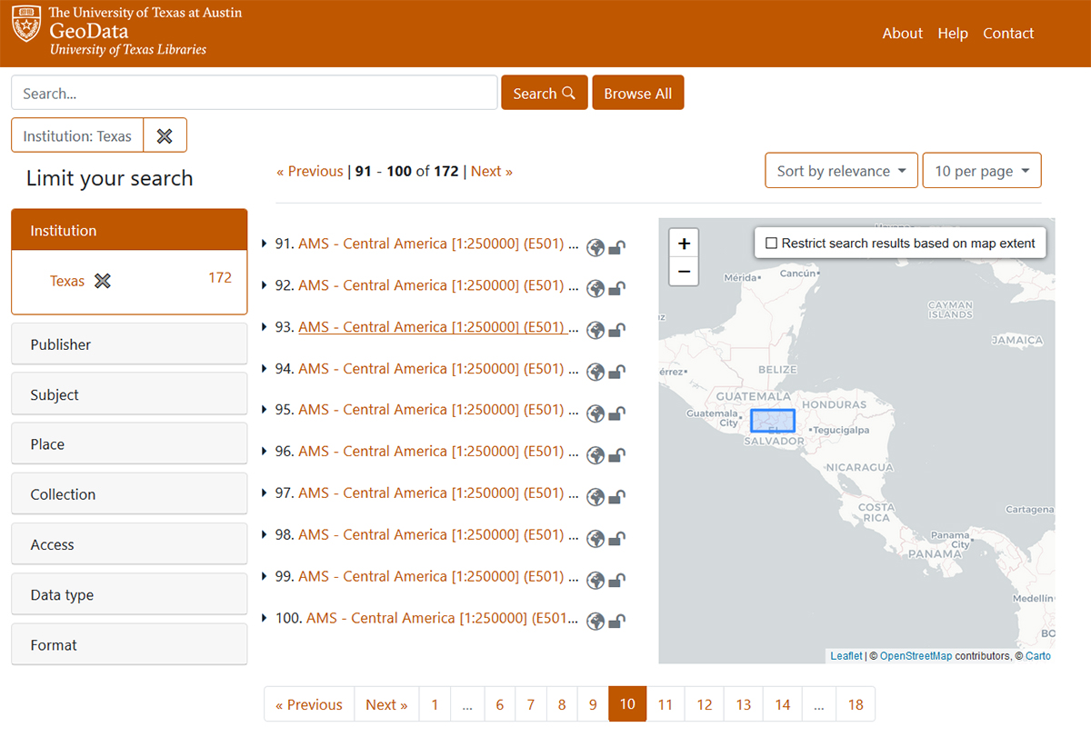
The Texas GeoData Portal uses an open source geospatial discovery application – GeoBlacklight – to power a web portal that gives users the ability to search, browse, preview, and download geospatial datasets. Visitors to the website will be able to search through a variety of geospatial datasets, including georeferenced scanned map images from the PCL Maps Collection and vector datasets developed from items in other special collections like the Benson Latin American Collection and Alexander Architectural Archives.
The portal will allow users to download data in several different standard geospatial formats so that they can easily be loaded into GIS software for advanced visualization and analysis.
Coordinated use of GeoBlacklight software and collaboration through the OpenGeoMetadata project has created a community among partner institutions for the sharing and standardization of data and metadata, expanding the opportunities for discovery and creating a robust search functionality among a large corpus of resources. Users can filter search results based on various dataset characteristics including geographic extent, subject matter, institution, data type, and format.
“I’m really excited to be a part of this project because I know this portal has the potential to benefit everyone in the campus community regardless of their role and area of specialization,” says Shensky. “Faculty can use the portal to find data for developing instructional materials, students can find data to use in research projects, and visitors will have access to a variety of unique maps and datasets that they can explore.”
The Texas GeoData Portal is in the closing stages of development with a full launch expected later in the fall, at which point users will be able to access the new resource through the Libraries’ website. Already discussions are underway regarding future functionality, which could include UT single sign on authentication for viewing license-restricted data, integration with the unified search on the Libraries’ website and integration with the Texas Data Repository and the Collections portal (more information to come on this project).